People across the country and digging into their closets for gloves and scarves ahead of the arrival of the first polar plunge of the season this week.
In what is being described as the coldest arctic blast since last winter, cities as far apart as Seattle and Chicago are expecting to cop a snow-coating in the coming days.
The cold is expected to stick around next week as well, near freezing and below temperatures forecast in New York, Illinois, Ohio, Missouri, Massachusetts, Michigan and Tennessee until Thursday.
But the cities to cop the cold in the next few days are those across the Northern High Plains in Nebraska, Colorado, Kansas, Texas, Wyoming, and other places, will be as much as 35 degrees colder than average for this time of year, according to the National Weather Service.
It is forecast Friday could be the coldest day in Dallas since winter 2015.
Heavy snow is also expected in the next few days in the Upper Mississippi Valley, and across the Appalachians.
The wintry spell could create headaches for travelers across parts of the east coast, with Accuweather expecting slippery and potentially snowy conditions on Interstate 80, I-81 and I-90.
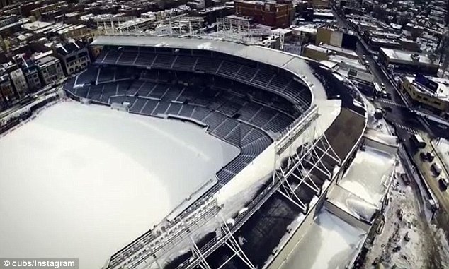
The World Series winning Chicago Cubs put out a video on Tuesday of the snow in Chicago, showing it covering the team’s famous Wrigley Field home.
The video, which was shot with a drone, started out high above the stadium, before flying down to field-level for a closer look at the freezing conditions.
It comes after it was forecast on Monday the arrival of massive cold wilds from the west started to push temperatures down from coast to coast.
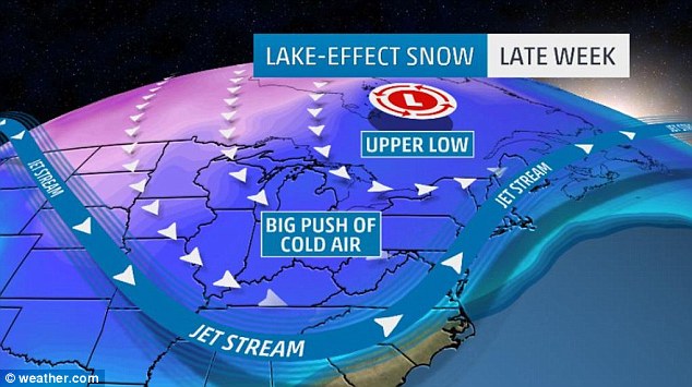
‘Frigid air from the depths of the Arctic will plunge into the United States as the jet stream (a fast-river of air along which storms travel) drops southward,’ the online forecaster stated.
The freezing winds are expected to impact temperatures in the Midwest on Wednesday and Thursday, before the east coast cops it on Friday.
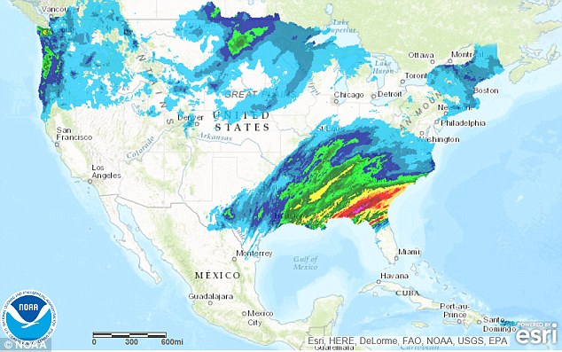
From El Paso, Texas to Jacksonville, Florida temperatures will barely climb to or above 50 degrees later this week.
Across the northern Florida Peninsula, temperatures could possibly drop below freezing.
‘For many places in the East, temperatures on Friday will be lower than at any point during last year’s unusually warm December,’ Thompson said.
More polar plunges are expected to follow next week as the cold snap locks in.
RELATED ARTICLES
- Biden Admin Sues Tennessee for Criminalizing Intentional AIDS Exposure
- Thousands of Australians getting sick with a 'super cold', but it's NOT COVID-19
- Tiffany Dover did NOT Die, She IS ALIVE, stop spreading Fake News! Here's the EVIDENCE
- Police Break Up 100-Person Amish Party for Violating Stay-at-home Order
- Ohio has 100,000 Coronavirus cases Top Health Official says


