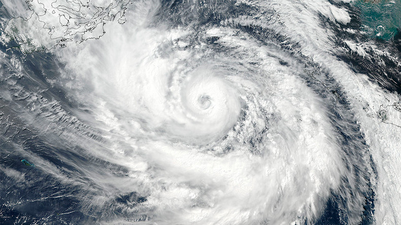
Typhoon Lan, a storm with an eye 50 miles wide, is expected to lash parts of Japan with intense wind and rain, the country’s meteorological office has warned. Currently west of Okinawa, the typhoon is travelling north towards mainland Japan.
According to forecasts by the Japan Meteorological Agency, the “large” storm will barrel across the nation on Sunday before subsiding on October 23.
NASA imagery reveals the huge scale of the typhoon, with pictures taken by the Suomi NPP satellite revealing powerful thunderstorms swirling around an eye 50 nautical miles in diameter.
The US space agency stated that on October 20, Lan’s wind speed reached a whopping 115 miles per hour. It clarified in a later tweet that the weather system has not been designated a “super storm”.
Extreme rainfall, described as “walls” of precipitation, were 3-D mapped by the Goddard Space Flight Center in Maryland earlier this week.
A number of Japan’s prefectures have been put on high alert for extreme gales and strong coastal waves. The US Joint Typhoon Warning Center is predicting that the storm’s threat will decrease gradually over the next 6 to 12 hours.
The agency said a “short wave trough” of pressure in the coming hours will begin the “gradual weakening trend” of Typhoon Lan.
RELATED ARTICLES
- Japan suspends Moderna Covid vaccine after another million doses found contaminated, bringing total to 2.6 million
- More people Suicide in Japan because of the Restrictions than the Virus Total Death Toll
- Japan releases Thousands of potentially infected Diamond Princess passengers onto the streets of Tokyo
- CATASTROPHIC ERROR: Diamond Princess cruise ship infected passengers allowed FREE TRAVEL
- Japanese Angry After Ukrainian Woman Wins Miss Japan 2024 Title


